
Waterfalls in North Georgia
Rabun County enjoys Georgia’s highest annual rainfall, an average of over 70 inches; 2 feet more than the City of Atlanta 100 miles to the south. With over 50 accessible waterfalls to view, this is the place to explore the state’s most beautiful waterfalls. Each one is different, some showing grand crashing beauty while others are delicate and dancing. Becky Branch is only five minutes and a short 200 yard hike from downtown Clayton.
In contrast, Martin Creek Falls is a reward for a four mile hike along the famous Bartram Trail. Dick’s Creek Falls makes a 60 foot drop over a granite wall into the “Wild and Scenic Chattooga River” of Deliverance fame. Here whitewater rafters and kayakers challenge their nerve and abilities in roaring Class IV and Class V rapids. Also spectacular are the 5 waterfalls seen in the 2 mile long, 1,000 foot deep Tallulah Gorge which was carved by the ancient Tallulah River. From the suspension bridge, which sways 80 feet above the rocky bottom, you can hear the roar of these 5 falls as they tumble through the canyon. Spring and fall whitewater releases create spectacular views as water thunders through the gorge. Once a mighty river, the Tallulah was damned in 1915 creating an incomparable string of sparkling, cold mountain lakes where residents and visitors can enjoy boating, skiing, swimming and fishing. With all of this spectacular beauty Rabun County is also a photographer’s paradise!
Waterfalls in North Georgia – More falls and Information is available on our CVB Website explorerabun.com
Angel Falls & Panther Falls – Both are cascading falls of about 50 feet and are located along Joe Branch Creek. Starting from the rear of the Rabun Beach Camping Area #2, it is a moderately strenuous one mile hike to the viewing bridge at the foot of Angel Falls. Panther Falls is located along the same trail at the ½ mile mark. Above Panther Falls, the trail ascends through a heavy rhododendron canopy along a number of other cascades.
Bad Branch Falls- a 20’ cascade, is 3.2 miles from the Lake Seed Dam. Take Lake Rabun Road to the dam, then cross the lake below the dam and go 0.3 miles to the stop sign and turn right on Crow Creek Road. Follow Crow Creek Road for 2.9 miles. The unmarked trailhead will be on the left. Allow five minutes for an easy to the falls.
Becky Branch Falls. Cascading falls of 20’.Follow the Bartram Trail north from Warwoman Dell approximately 0.25 miles to a foot bridge at the base of the falls. The trail will ascend steeply in places.
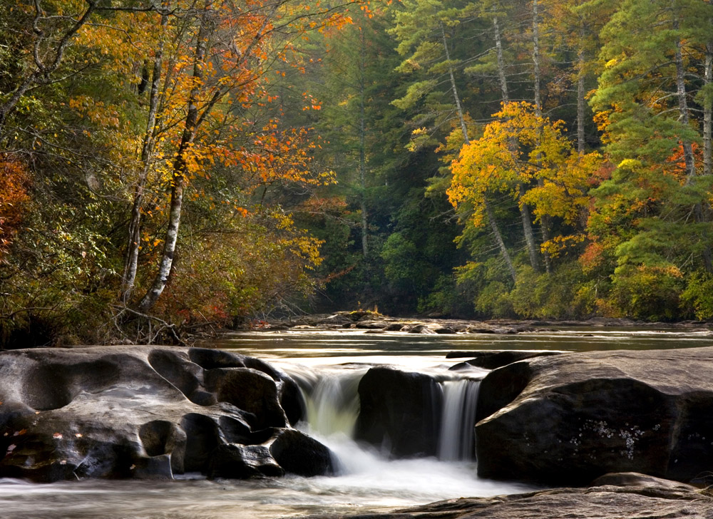
Bull Sluice (15″) – is a beautiful whitewater cascade popular with kayakers. From Clayton, take Hwy 76 East to the SC line. Park on the SC side of the bridge and follow a paved path from the parking area. At a sharp left turn in the path, continue straight on the gravel path. The sluice is less than a quarter of a mile ahead.
Darnell Falls – an energetic 30’ cascade that is very easy to reach and view. It is in the Chattahoochee National Forest in Rabun Gap. Travel north six miles out of Clayton on U.S. 441 and turn at Kelly’s Creek Road. Go one mile to Darnell Creek Road. Follow Darnell Creek Road and bear left at the fork. The pavement ends here. Continue about 0.3 miles to a second fork. Park and walk down the right fork of the road approximately 200 yards to the falls.
Dicks Creek Falls plunges 60 feet into the Chattooga River on the eastern side of Rabun County. Follow Warwoman Road 5.8 miles east from Clayton, then turn right on Sandy Ford Road. Follow Sandy Ford Road for four miles to the trailhead at the ford on Dicks Creek. Hike a ½ miles downstream to the falls.
Hemlock Falls – a 15’cascade, is in Moccasin Creek State Park on Lake Burton. The trail is one of Rabun County’ most scenic and features two pretty cascades falling into Moccasin Creek. From the trailhead, follow the trail about one mile up the left side of the creek, crossing the creek on a wooden bridge shortly before reaching the falls.
Holcomb Creek Falls & Ammons Falls. Holcomb Creek Falls has a dramatic 120’ drop featuring a free-falling upper cascade and a steep, sliding lower drop. The moderately strenuous 0.3-mile trail to Holcomb Falls begins at the junction of FS-7 and FS-86, 6.5 miles off Warwoman Road. The trail descends steadily until it reaches the observation bridge at the falls. Continuing on the trail of one quarter of a mile leads to the viewing deck at Ammons Falls, a 40-foot waterslide. This is one of NE Georgia’s loveliest hikes.
Minnehaha Falls one of the most photographed, water tumbles 100’. is 1.6 miles from the Lake Seed Dam, about a five minute walk from the parking area on Bear Gap Road.
Stonewall Creek Falls. 20’Cascade. Follow Old Hwy 441 north to FS-20 on the left. Follow FS-20 1.7 miles to a primitive camping area at the base of the falls.
Tallulah Gorge State Park is home to five major falls: Hurricane (96’), L’Eau d’Or (46’), Tempesta (76’), Oceana (50’), and Bridal Veil (17’). Each April and November, Georgia Power releases water on weekends to increase the water flow for recreational purposes. A three-mile loop trail gives access to several overlooks and includes steps descending to a suspension bridge spanning the gorge within 85 feet of the gorge floor.